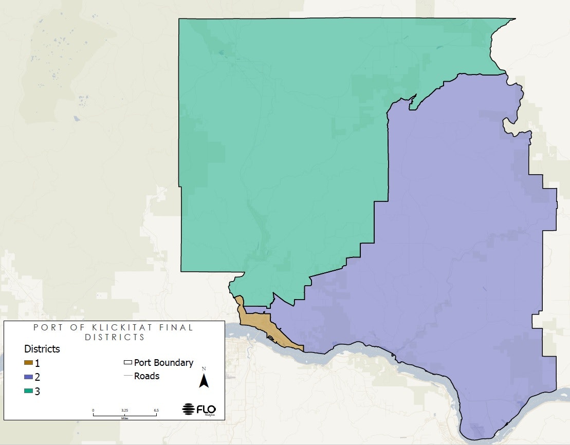
District Map
The Port District covers the geographical western third of the county. Its borders are the county lines to the north, west, and south (the Columbia River) and an imaginary line running from the Columbia River to the north county line just east of Wahkiacus. The Port District is divided into three commissioner districts, the elected representatives of which form the three-member Port Commission.
- District #1 represents 4,478 people who live in the approximate areas of Bingen, Fruit Valley, and White Salmon.
- District #2 represents 4,491 people who live in the approximate areas of Appleton, Klickitat, Lyle, High Prairie, Mountain Brook, and Dallesport.
- District #3 represents 4,482 people who live in the approximate areas of Glenwood, Husum, and Trout Lake.
2020 Map
District 1 Map.pdfDistrict 2 Map.pdfDistrict 3 Map.pdf